News
Cox and Dinkins Adds Drone Surveying Technology
February 2, 2025
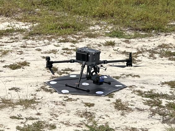
We are excited to announce that Cox and Dinkins has added drone technology to our survey department. This technology will be utilized to provide high resolution photography and LIDAR mapping on topographical and other survey projects. Jason Powers has been named UAV Director of Cox and Dinkins. Both Jason Powers and Tuck Benifield have their FAA 107 license.
The drone, which is a DJI Matrice 350 RTK Drone, has already been utilized on numerous projects. The drone enables us to map topography on large sites more efficiently than ground run surveys with minimal sacrifice of accuracy and also provide high resolution photography of project sites to our clients.

Read All News
Experience Matters
We rigorously design to deliver the best possible solution for your project.
Meet Our Leadership